Creating a drone-generated 3D model has always been part art and part science. But at DroneDeploy it’s our goal to make it simpler for anyone—no matter their skill level—to make high-quality drone maps and 3D models using our software. That’s why we’re excited to announce Structures Mode.
3D Models. Simplified.
Structures Mode is designed to simplify the data capture process for anyone who wants to make a high-quality 3D model using their drone.
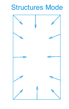
So how does it work? Structures Mode captures oblique images from the perimeter of your mission plan, facing towards the center of your subject— while eliminating the horizon in the photos.

The best part? Structures Mode is optimized to automatically collect the lowest number of images required to make a good model. Instead of needing hundreds of images, you can now get crisp models with just dozens of photos. This means that your model will process faster in the cloud, and you won’t have to wait as long for a finished product.
How to Use Structures Mode
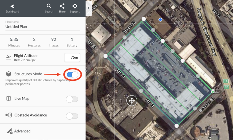
Using Structures mode is easy. In the DroneDeploy app’s flight plan settings, enable “Structures Mode” by flipping the toggle. That’s it.

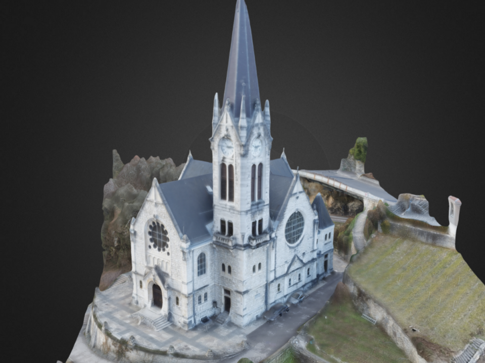
Here is an example of a recent model we made of our office. This model was made with just 40 images captured in less than ten minutes.

Supported Hardware
We built this feature for recent DJI Drones, released since the Phantom 4. Please take a look at our list of Supported Drones to learn more about compatibility with your drone and the DroneDeploy flight app.
So what are you waiting for? Give Structures Mode a try during your next flight. We know you will be impressed.