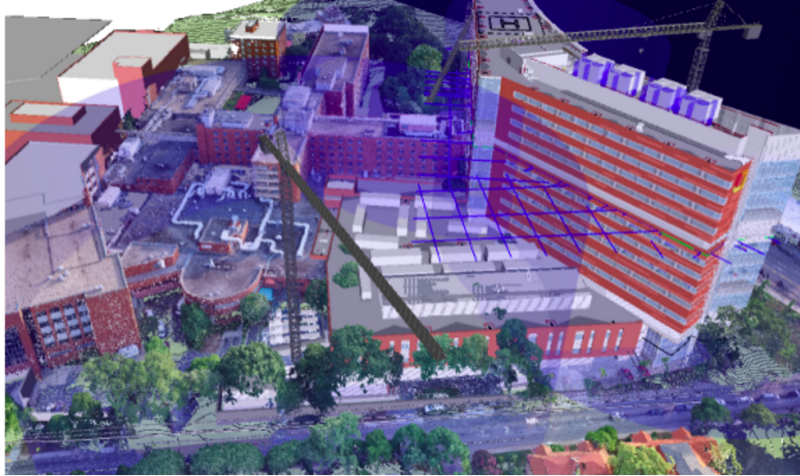
Integrating Drone Point Clouds in BIM Enables Powerful Analysis A completed drone-generated point cloud is just the beginning. The real power comes once that model is integrated into BIM software. The Brasfield & Gorrie team generates point clouds in DroneDeploy and then imports data into Autodesk Revit, where they overlay it with the 3D site plan […]